The Cabinet of the United States

This six day unit contains a few elements of pedagogy I am particularly interested in. It starts with a simulation intended to help students understand why a national leader might want or need trusted advisors with particular expertise to delegate large tasks to. Only after they experience that need, do we introduce the reality of the cabinet.
Students choose a cabinet department they are interested in and research it. Their individual work goes through a Google form so that it can easily be shaped into a tangible product – a cabinet reference guide for the entire class. Students next use this guide to answer questions about the entire cabinet, an activity which encourages them learning from each other.
The last section of the unit focuses on how the role of the cabinet has shifted over time. Students develop their understanding and opinions about this topic while practicing critical reading, information synthesis, and essay writing skills.
American Government and Politics • Cabinet Unit
Dazzle Camouflage and the Art of Historical Vision
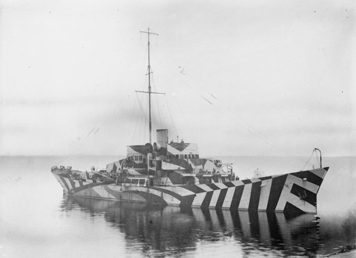
I had the pleasure of leading three classes of high school sophomores and one class of graduate students through this historical warmup activity. I began by handing students a half-sheet of paper with two sections for writing down ideas. One section is for observations, the other for inferences or guesses about what they see means. After a period of silent contemplation, students shared only their observations for a few minutes while I annotated the image based on what they had seen. Finally, they were given permission to share their conclusions about the photo. Where was it taken? When? What’s the explanation for the strange paint? How can we tell?
I was hesitant to swoop in at the end with the “correct” answers, so instead, I abridged a podcast on the topic and had students listen to it while taking notes on what they had guessed accurately and what not. In my graduate class, the audio did not work, so I contextualized the photo myself. That worked nicely in that setting, so perhaps I will try it that way the next chance I have to teach this lesson in high school.
As you may have noticed, I haven’t given any spoilers in this description. I encourage you to try the lesson out yourself! It’s a fascinating topic. Let me know how you do.
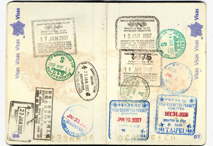
Passport to Europe
During my time teaching seventh grade geography this spring, I adapted a unit from the legendary middle school geography teacher and adjunct Tufts professor, John Daly. In my version of the unit, I had students pretend that our school had received a grant to travel to one country in Europe the following year. Students chose or were assigned a country to research and present to the rest of the class.
Each student’s research and presentation followed a path that I had set up and included basic information about the country, descriptions of its people and its physical geography, pictures of sights to visit, and a climograph showing average temperatures and precipitation throughout the year. You can view the template here and a few of the resulting posters below.
One fun element of every poster was a passport stamp. This was meant to be a single composition which represented the student’s country. Before students glued their stamps onto their posters, I scanned them and minimized and duplicated them. This gave them the opportunity to hand out miniature versions of their stamp to their classmates as part of their presentation. Each student in the class collected these stamps and pasted them into their own “passports” which also functioned as a note taking sheet.
To finish the unit, I had students complete a three-part quiz during which they were allowed to use their passports. My idea was that students would be able to use the collected data from their passports to create ranked lists and visualizations of area and population. I quickly saw that most students needed help, so I created a few differentiated cheat sheets with varying amounts of data. Despite or perhaps because of this, I was pleased with the quality of my students’ engagement on this part of the unit. They spent a lot of diligent time ranking countries and charting or mapping the data and the tangible results and learning outcomes were impressive. The quiz ended with an essay about the country or countries students would most like to travel to and why.
Gerrymandering
 Gerrymandering is a fascinating topic for many reasons. As a vitally important political tactic, studying it has clear application to answering the basic question of every history class: Why are things the way they are today? Understanding what Gerrymandering is and how it works is good, but the goal of this lesson is to give students a chance to experience Gerrymandering themselves. The heart of this lesson is a set of scenarios in which students are asked to redraw district lines to achieve different political results. Only after personally manipulating election results do students learn the power of Gerrymandering.
As a secondary goal of this lesson, I hope that students will notice the general power of process; that the ways in which a decision is reached can be extraordinarily important to their outcome.
The Connecticut Compromise
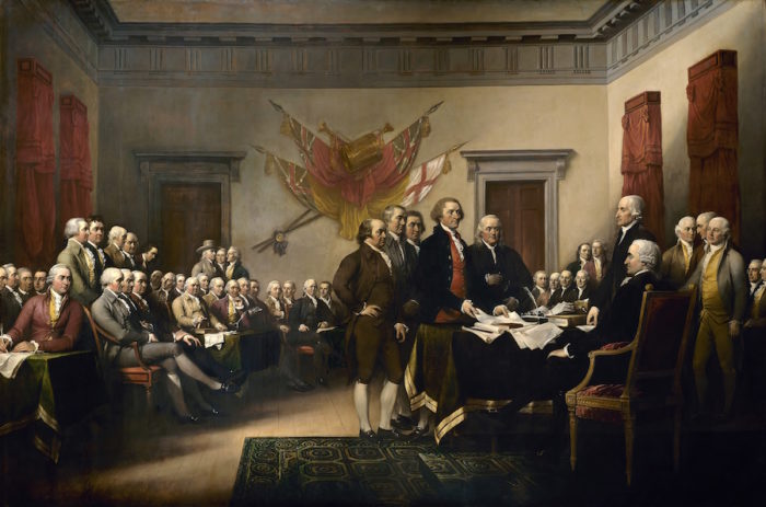
They say there’s no crying in baseball but no one ever said there’s no math in history. I must admit that there was an audible groan when I first mentioned that we’d be using math to understand the Connecticut or Great Compromise from the Constitutional Convention.
From a skill perspective, I designed this lesson to help students with the valuable skills involved in reading, comprehending, and contributing to data tables. In terms of content, my goal was to connect the sometimes dusty-seeming history of the Constitutional Convention with the all-too contemporary issue of the electoral college. I think it worked. At least, by the ten-minute mark of the lesson, there was no more groaning from the students!